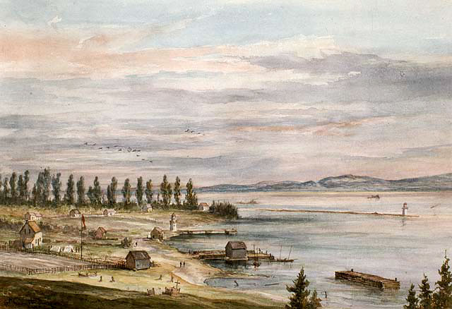
EDITOR’S NOTE: This week Shelley Pearen continues her series on the 19th century Manitoulin surveys. Ms. Pearen described the initial survey, the Anishinaabe reaction to the surveyors and the surveyor’s descriptions of Assiginack, Bidwell, Billings, Howland, Sheguiandah, Tehkummah, Allan, Campbell and Carnarvon Townships in five articles published in The Expositor in 2014. Today she depicts Manitoulin in 1865-66 and summarizes the Sandfield and Gordon Township surveys.
by Shelley Pearen
One hundred and fifty years ago, in the winter of 1865, the residents of Manitoulin Island were suffering from the long-lasting effects of devastating fires that had ravaged large portions of the island the previous summer.
Charles Dupont, the local superintendent of Indian Affairs, described the damage to his superiors. “The fires on the Island this summer [1864] have been most appalling and have extended more or less over the whole Island stretching over and laying waste tracts of land of ten, twenty or thirty miles in length.” Dupont described the loss of crops, houses, barns, and land and requested financial assistance for the Indian residents.
Dupont also reported that the fires had affected the surveys. “The Townships surveyed last winter have suffered greatly – the lines being obliterated and posts consumed, and it will be almost impossible where there are lots left fit for settlement, for intending settlers to know what number they are in, or to what section they belong. The same difficulty will exist on settling Indians on their one hundred acre lots. In fact to a very great extent the survey will have to be made over again or might as well not been made at all.”
Dupont’s superiors reacted. He was sent $2,400 to buy supplies, though with the stipulation that the money was to be repaid by the Indians from their annuity money and future fish sales. Additionally, despite his descriptions of fire damage, he was sent maps of Howland and Bidwell so he could prepare for land sales.
In the spring of 1865 Dupont proceeded with band mergers and resettlement while Manitoulin’s Anishinaabe residents gathered in council to unite in opposition against the 1862 treaty. The residents of the Wikwemikong Peninsula had successfully resisted the treaty but they were experiencing a lot of pressure from oil speculators eager to take advantage of reputed petroleum sites.
By the spring of 1866 the department of Crown Lands was desperate to sell lots on Manitoulin Island. Government officials believed that sales of the Manitoulin land would be welcomed by voters, whether they were settlers or speculators, and finally curtail criticism of the 1862 Manitoulin treaty.
It is interesting to note that William Spragge, the man who master-minded the achievement of the treaty for William McDougall the superintendent general of Indian Affairs in 1862, was now himself the superintendent general of Indian Affairs. Essentially the sale of Manitoulin land was the culmination of four years of work on Spragge’s part.
Lots in Howland, Sheguiandah, Bidwell and Billings were released for sale in June 1866 though many Anishinaabe residents were still living on their land in these four townships. The 1862 treaty specified that they could not remain on potential town sites, harbours, or mill streams so most Island residents were threatened with relocation. The residents of Little Current, Manitowaning and Sheguiandah were particularly reluctant to move.
Nevertheless land sales proceeded. Lands for settlement were sold at 50 cents an acre with a requirement for immediate and continuous residency for three years. Land could also be purchased for mineral or oil purposes in the unsurveyed portions of the ceded land, essentially everywhere except the Wikwemikong Peninsula.
The land sold at a much slower pace than the government had anticipated. In May 1867 the price of land was reduced to 20 cents an acre. In 1868 Carnarvon, Campbell and Assiginack townships were released for sale and Allan in January 1869. Sandfield was surveyed in 1870 and Gordon in 1871.
Sandfield Township
James William Fitzgerald surveyed Sandfield Township in 1870. “As regards the quality and kind of land and timber in this township, it may be divided into two sections – east and west halves.”
“The easterly half, bordering on Lake Manitou is generally level and covered with a growth of hardwood, hemlock and pine. The soil is an open clay loam apparently of a fertile nature and free of stone. Through this part of the township, very good farms could be chosen, and upon them a plentiful supply of building material and firewood is obtainable. White’s River, flowing out of Manitou Lake has its source on the easterly side, and is a broad, clear, shallow stream, seldom exceeding two feet deep, and in this way it continues almost its whole length to Michael’s Bay. The whole of the 11th concession is composed of excellent land, yielding a heavy growth of maple, birch, beech, basswood, & c., and, as a general thing, the land comes down gradually to the level of the lake.”
The west half of the township is considerably broken by abrupt knolls, and contains a large proportion of evergreen timber with occasional tracts of maple and hardwood land interspersed. In the south-west part, a large quantity of good white pine occurs, apparently of a sound and healthy kind. Though a good deal of fair land is met with in this part of the township, it is, on the whole, rough, and hardly suitable to help much towards a prosperous agricultural settlement.”
_Fitzgerald concluded: “I have no hesitation in putting down 50 per cent of the township as fit for cultivation, and with the advantages which a residence on this island affords, and the facilities of access offered, it would, I have no doubt, be for the benefit of many to pay it a visit before settling down elsewhere.”
Gordon Township
Edgar Bray surveyed Gordon Township in 1871. Though initially named Sherborne Township the name was quickly changed to Gordon when it was realized that Sherborne had already been used.
Bray described about half the township as good agricultural land, well adapted for settlement. He praised Gordon, going as far as listing its advantages. It was “near the route of navigation of the Lakes,” had a good harbour at Gore Bay, had a “large proportion of good agricultural land, and most of its good land lay in one large block, basically the middle of the township, north of Tobacco Lake.
He described the land west of lots 21 as rocky or swampy and without value, and south of concession 4 as rocky and very hilly. The soil was a sandy loam in the East and West ranges, a clay loam west of the West range, and clayey east of the East range.
At the time of his survey Gore Bay was an unsurveyed village of 200, with a Presbyterian church, post office, grist mill, saw mill, hotel, and several stores.
In September 1874, three years after Gordon had been surveyed, the local agent J.C. Phipps reported to his superiors that “a large number of settlers are located in the Township of Gordon, especially in the neighbourhood of Gore Bay, and that several have squatted on the Reserve for a Townplot at that place, having built dwellings thereon and that a Post office has been established there.” Phipps recommended that the Gore Bay Townplot be surveyed as soon as possible and provided a diagram indicating the potential subdivision of the land.
In future columns, Ms. Pearen will describe the surveys of Manitoulin’s western townships and reveal who the townships were named for. Shelley Pearen is the author of ‘Four Voices The Great Manitoulin Island Treaty of 1862’ and ‘Exploring Manitoulin.’ She has been researching Manitoulin history for more than 40 years.


