Municipalities, businesses plan against possible one foot more water
LITTLE CURRENT – News that Manitoulin waterfronts could be facing a spring rise of upwards of 30 centimetres in comparison to last year has the Northeast Town planning ahead for the possible disruption to its port.
Northeast Town CAO Dave Williamson expressed concern to council during its preliminary budget deliberations, explaining that an increase in water levels will mean an additional expense to the municipality.
He pointed to the United States Army Corps of Engineers projection that Lakes Michigan and Huron could rise by 30 centimetres in March compared to the same time last year.
“We have to take the approach that we’re going to lose a large chunk of our town docks,” he told The Expositor.
As such, the municipality has applied for climate adaptation support from FedNor which would be used to purchase two additional floating finger docks that would be installed downtown to replace the lost dockage along the town wall that would, if predictions come true, be underwater.
All of the finger docks, both old and new, would then be attached to the downtown wall via ramps.
The Northeast Town will also be seeking the professional opinion of the Technical Standards and Safety Authority (TSSA) as to whether the power pedestals along the town dock should be moved, or raised.
The municipality also plans to raise the east weir to accommodate cruise ships’ tender boats. Dockage along the town wall this summer was tenuous at best with one cruise ship causing damage when it docked due to the high water levels. (This situation was later remedied and the cruise ship was again able to anchor safely at the town dock.) In case of high water levels, the cruise ships would no longer be able to park downtown, but would anchor nearby and passengers brought ashore via tenders.
If the predicted rise does not come true, or if the levels recede, Mr. Williamson said the fingers docks would then go to Spider Bay Marina, so nothing would go to waste.

Right now, there is two inches of clearance from the water to the top of the downtown docks. With a good south wind, waves easily cover the docks.
The municipality will also install landscaping stones along the low end of the town wall where it is more susceptible to high water, thereby keeping the soil and grass from eroding from wave action.
“The basement of this building is also going to be subject to flooding,” Mr. Williamson added, pointing to the municipal/post office building that lies close to the water’s edge. The municipality will be installing a series of pumps for the likely inevitable flooding that will occur.
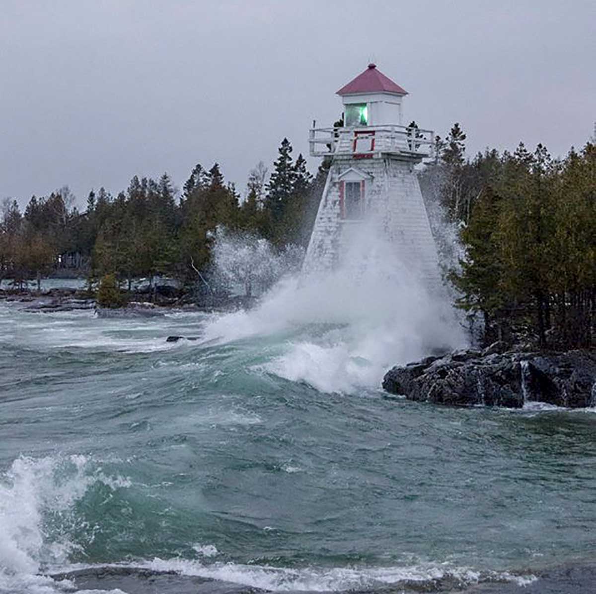
Low Island Park was already a concern last year with the swimming docks completely underwater. The gazebo located near the Low Island beach was also close to being submerged, with Mr. Williamson noting that it will have to be moved next year.
There are no plans yet for the government dock in Sheguiandah, which would be rendered completely useless by such a drastic rise in levels.
In Honora Bay, Lakeshore Road also saw felt the effects of rising water over the summer months. Public works crews installed gabion cages along the water side of the road to prevent erosion, but Mr. Williamson worries that they, along with Billings Township, which also has a stake in the road, will have their hands full.
The Northeast Town is applying for climate adaptation funds in two stages: first, the materials; and second, the fingers docks themselves.
“We’re trying to be proactive,” Mr. Williamson said. “At a minimum, we’re ensuring we can continue to host the cruise ships.”
Billings is also having to account for high water as they continue with the Kagawong Waterfront Development project—“and it is adding to engineering and very likely the cost,” Billings Economic Development Officer Todd Gordon said. “Lake Huron is near historical high water now, so it’s quite probable that it will reach or exceed that next year. This is the most serious direct impact to date for the municipality, although there are ongoing and probably worsening impacts for some private property owners. One of the greatest impacts, of course, is the uncertainty this situation is creating for municipalities, other levels of government, and private property owners.”
The projected rise will not have the same impact in Assiginack as in the Northeast Town, CAO Alton Hobbs told The Expositor.
“We’ve had preliminary discussions, but don’t expect it to have too much of an impact on the Manitowaning marina,” he said. “Everything but the header is a floating dock.”
If need be, the CAO said the head can be adjusted to accommodate a drastic rise on levels, however.
Assiginack also maintains a public access point to South Bay, but staff does not expect it to become unusable, as is the case with Sheguiandah.
Tehkummah has already dealt with the effects of climate change a couple of times this fall.

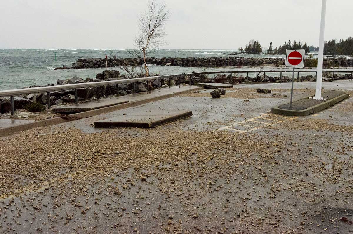
“That’s a topic we’re discussing this morning,” T. Silvio Berti, Tehkummah clerk, said when contacted by this newspaper on the topic of high water levels. He explained that he had just received word that Sunday’s high winds had washed away a portion of boardwalk in South Baymouth that leads to the small island, complete with its gazebo, located near the marina and playground. Over the Thanksgiving weekend, too, high winds caused much rock debris to wash over the break wall and onto the ferry traffic lanes.
“We will be discussing whether we should be replacing the boardwalk, or should we bother? Or maybe we could raise it up,” Mr. Berti said. “At this point, we haven’t planned for anything, but we’re already being affected.”
The clerk said the topic of what to do will be discussed at future Tehkummah council meetings.
Susan Schrempf, Owen Sound Transportation Company CEO and president, which runs the Chi-Cheemaun ferry, said it’s still too early to make predictions, saying she prefers to wait until Environment Canada issues a warning.
“Anything is possible between now and the spring,” she added. “Predictions between now until then can vary widely.” Ms. Schrempf said she will begin looking at trends in January.
At Little Current’s Harbor Vue Marina, owner Kevin Rose said a 30 centimetre raise next year would “certainly” impact operations.
“We had to increase our dockage facilities this year to compensate for the dramatic increase in water levels,” Mr. Rose said. “If we raise the docks too much and the water recedes, we’ll have a whole different set of issues.”
Mr. Rose said he is planning measures to ensure fixed dock structures will be utilized without having to wade in water. “We are fortunate that we have a majority of floating docks in place.”
“We can only fix what we have on a micro level; Mother Nature will handle the rest,” Mr. Rose added.
Little Current’s Boyle Marine has also already been dealing with high water levels and had to bring in fill to place in a low few spots in the marina, explained owner Brian Boyle. He anticipates having to do the same again next year should the levels rise to the predicted levels.
“The berm facing the downtown was pretty much underwater all summer,” he noted.
Like Harbor Vue, most of Boyle Marine’s slips are floating, but it’s the land to get to those slips that could be the problem, hence the fill.
“We’ll just deal with it in the spring, I guess,” Mr. Boyle said.
Annette Clarke, CAO/clerk of the Town of Gore Bay said the municipality fared well with the past summer’s high levels, only seeing flooding at the portion of dock where Norm Fogal’s boat lift is located. Gore Bay also utilizes floating docks and its main dock was well above the water’s edge, so Ms. Clarke said she’s not too concerned. “We think we are okay,” she laughed.
“But like anybody else, if it gets to that point, we’ll have to do something,” Ms. Clarke added.
Over on Burnt Island, the home of Purvis Fisheries, Denise Purvis, vice president of the company, said she and her family are hoping that the water goes down, not up. As it is, water levels are precariously close to the processing plant, built close to the water’s edge for the ease of getting the day’s catch into the plant, ready and shipped off to destinations far and wide.
If the water rises by a foot, the water will be inside and then the fishery runs the risk of having its processing station shut down for health and safety concerns.
The docks at Burnt Island, too, are already problematic. Ms. Purvis explained that they have been modified to meet the summer’s rise, but any more water will mean problems for the big fishing tugs.
“It’s not going to be good,” she said.
Ms. Purvis and her father George also sit on the harbour authority, comprised of local commercial fisheries on Manitoulin and the North Shore. They oversee the Cook’s Bay dock on the North Channel near Silver Water and the dock at the Providence Bay marina, but the Department of Fisheries and Oceans (DFO) owns them.
She noted that the DFO hosted a meeting a couple of weeks ago and that her father attended. High water levels are definitely on their radar, but they made no promises as almost all of their Great Lakes docks will be facing the same fate.
When it comes to Providence Bay, Ms. Purvis said the harbour authority will have to decide come spring on whether or not they will have to shut the finger docks down, leaving recreational boaters and fishermen in the area to find a new place to dock.
Ms. Purvis said the real problem comes from water being held back from Lake Superior to appease people at the end of the Great Lakes chain.
“And we’re stuck in the middle,” she said.


