
WIIKWEMKOONG – Wiikwemkoong, in partnership with Natural Resources Canada (NRCan) Indigenous Forestry Initiative, has received a grant of $155,280 toward its forestry business program, enhancing its technology to take advantage of new and future opportunities and support several jobs in the community.
“This is a door that’s opened for us,” Wiikwemkoong lands and natural resources director John Manitowabi told The Expositor. “It will be exciting to see how far we can push things with this technology.”
NRCan has committed $13 million between 2020 and 2023 in support of Indigenous forestry projects across Canada and it has distributed $6.8 million of that to date.
Wiikwemkoong’s funding will go toward hiring a consultant to update the business plan of the for-profit division within the lands department. That division does contract work for governments, corporations and other partners.
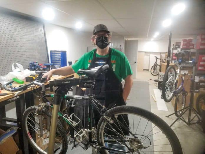
The funding also covers two new specialized drones and training on how to use them, which carry a combined value of about $90,000. Training sessions were underway when The Expositor visited Wiikwemkoong last Wednesday, May 12 to learn more about the project.
Mr. Manitowabi explained that lands departments within First Nations tend to not receive enough funding to cover all of the parts of their operations. To make up for the shortfall, Wiikwemkoong’s lands division in 2011 launched a component called Forest Resource Inventory, which bids on government contracts for forestry and lands management work as a way to generate revenue for the department.
“We have a large First Nation and we have a large terrain to manage, so in order to have the staff available, we do contracts that generate revenue to keep people employed,” Mr. Manitowabi explained.
The Ontario government contracts vendors to assess its provincially managed forests by going into the woods and gathering information on the state of the forest, plus gathering photos and geographic information systems (GIS) data for further analysis on observations that need more processing than is available in the field.
In recent years, though, the province switched to employ aerial technologies instead, leaving Wiikwemkoong unable to complete the work.
“We said we needed to start thinking differently about what how we could still be in that business, but think differently as to what else we could do,” Mr. Manitowabi said. “At the same time, NRCan put out a call for proposals for Indigenous organizations to submit plans for forestry issues. We submitted a proposal and then we were successful in our mission.”
Wiikwemkoong purchased two Microdrones units through Cansel, a Canadian reseller. Despite the manufacturer’s name, these drones are anything but micro.
The units measure a few feet across and weigh 6.5 kilograms when equipped with their technical equipment. They feature four arms, each tipped with a carbon fibre tri-blade array to provide thrust.
The principal scanner uses LiDAR (light detection and ranging) which sends several lasers down centimetres apart in a certain area, and measures the light that returns. This allows it to create a detailed topographic map of the underlying ground, as if there were no trees or other obstacles in the way.
The LiDAR unit also has a high-resolution camera that creates orthographic (geographically referenced) imagery from above for gathering further information from the flights. This can also be used for visual inspections of hard-to-access structures, such as wind turbines and hydro lines.
The second drone can be equipped with thermal imaging systems, which among other things, can be used to fly over a solar farm and identify which panels are not functioning at optimal capacity. It also has a multi-spectral camera that can fly over agricultural fields and identify which crops are healthy and which ones may need more nutrients.
“What we want to do is try to broaden our ability to bring contracts and generate employment for our communities,” Mr. Manitowabi said. “As we build this capacity with these contracts, we start generating employment and revenue, and then we’ll purchase a few more drones and build up a team of people to be able to go out and collect, process and analyze the data and submit the final product to the client.”
The drones can follow pre-programmed flight paths, based on GPS tracks, but the Cansel trainer was teaching the crews how to safely pilot the units manually in case they should need to land immediately or if high winds suddenly appear and cause dangerous flight conditions. The drones fly for roughly 40 minutes in optimal conditions with lighter equipment setups.
The lands department’s focus for the short term is to learn the technology and get used to processing and analyzing the data. Its teams will work with Vermillion Forest Management Company, which manages the Sudbury Forest, in which Sagamok Forestry Corporation has harvest allocations.
“Right now, it can be hit and miss with the data you get from the forest industry, so we want to be able to fly this to know exactly how many trees there are from the volume, and then we can know more about the terrain too to manage where the skidder trails should be to be most effective and less damaging to the environment,” Mr. Manitowabi said.
Some of the department’s past contacts have already expressed interest in working with the new technology, giving Wiikwemkoong hope for its future returns. Its only current active contract is with Ontario for forest inventories, as well as occasional work with other communities for GIS and mapping.
Its staffing numbers were as high as 18 in the peak of assessing wide swaths of the province’s forest; Mr. Manitowabi said he hoped the numbers would get back to that level. The barriers they will face are the far distance his crews have to travel from Wiikwemkoong as well as finding qualified people who can perform the technical work of interpreting the data. Without accurate interpretation, the work is all but useless.
“We want to demonstrate this (technology) to the kids at the high school at some point and say, ‘look, this is new technology that is out there that’s probably going to grab your interest, but you need to take these courses in high school and go to the right college to get these kinds of jobs’,” Mr. Manitowabi said.
Wiikwemkoong director of operations Kevin Wassegijig was there to see some of the training and said it was great to combine traditional knowledge of the land with modern technologies.
“It definitely opens up more opportunities. I mean, the quality of work this thing can produce is second to none,” Mr. Wassegijig said. “I want to acknowledge Todd (Lewis, Forest Resource Inventory manager) and John (Manitowabi) and our staff that worked really hard to bring it to fruition.”
Having this technology available in Wiikwemkoong will also benefit band members, especially those managing estates that involve a person’s property. The current options of on-the-ground surveys are very time- and cost-intensive and drones will ease that process, too.
“We have over 300 estate files that are dormant because they require surveys to close the estate and some individuals can’t afford a survey because a survey averages about two to three thousand dollars an acre,” Mr. Manitowabi said. “Instead of being two, three, four thousand dollars, it may only cost $600 to $1,000 with the drones.”
Federal Natural Resources Minister Seamus O’Regan applauded the long-term economic development opportunities and investments like this will bring to communities for years to come.


