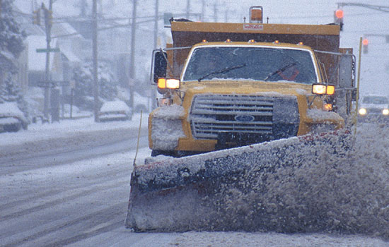
MANITOULIN—Although this winter has seen a fair amount of major snowfall events that have caused above-average accumulation, the season has not set any snow records—yet.
“I looked at the Sudbury snow numbers and found some interesting stuff that’s representative of what we’ve noticed all the way up to Kapuskasing,” says Marie-Ève Giguère, a warning preparedness meteorologist with Environment and Climate Change Canada.
December saw a snowfall amount of 63 centimetres in Sudbury, exactly the normal amount for the month. January received a metre of snow in comparison to the normal 60 centimetres. February has already exceeded the normal amount of 52 centimetres.
“In Gore Bay, (which hosts a weather station at its airport) there’s 46 centimetres of snow on the ground and the median number is 31 centimetres for February,” says Ms. Giguère.
Although Gore Bay’s snow accumulation seems rather high at 50 percent above normal, the accumulation in Sudbury is 60 centimetres, compared to a median level of 30 centimetres. The median level is based on a 30-year climate normal.
The problem with directly comparing Manitoulin Island’s snow status to the conditions in Sudbury is a difference in monitoring stations. Sudbury conditions are still measured by staff, but many weather stations in smaller centres such as Gore Bay have turned to automated systems. Gore Bay, for instance, does not track total snowfall; rather, it reports the snow accumulation that remains on the ground.
Snowfall records are also not measured by winter season. Rather, they are tracked by calendar year, meaning any snowfall this season before January 1 would be included with last year’s values.
Using data from so far in 2019 and manually adding in snowfall amounts from October, November and December, this season has seen 281 centimetres of snow fall in Sudbury. The normal amount per calendar year is 263 centimetres.
In Sudbury, since 1954, the highest snowfall in a calendar year happened in 1985—390.1 centimetres. That same year in Gore Bay, snowfall totalled 460.1 centimetres. The normal was 267 centimetres.
Ms. Giguère says the repeated snow events have stemmed from a stubborn jet stream that has been locked in position for quite some time, directing low pressure systems from the Rockies near Colorado.
“This year, it’s been further north and it’s not changing. It’s going to remain for at least the next week,” says Ms. Giguère.
None of this season’s snow events have come close to “storm of the century” levels, but there have been several storms in a row which have added up to a snowy winter.
“I have a feeling that it’ll be remembered as a busy season,” Ms. Giguère says.
Disruptions
Canada Post has issued several alert days affecting either all of Ontario or parts near Manitoulin since January 28.
“We’ve had four service alerts so far this year that have affected Manitoulin; a red alert (full service suspension) on January 28 followed by a yellow alert (delayed service) on January 29 and, just this week, we issued a yellow alert on Wednesday which is still in effect today,” writes Canada Post spokesperson Nicole Lecompte in an email to The Expositor.
Last year, Manitoulin’s only mail disruption was a yellow alert on April 16 due to severe snow and ice accumulation.
“This year’s weather has proven to be a challenge to date with record snowfalls in some regions as well as extreme cold temperatures,” states Ms. Lecompte.
“We are asking homeowners to keep our people and others safe by keeping a clear path to their home (or rural mailboxes).”
Canada Post employs 22,000 delivery employees and in the first four weeks of 2019, 270 have fallen while on delivery runs.
Following an alert, she says Canada post focuses on employee safety but works to return to its schedule.
Snow removal also takes away time from famers’ many tasks. However, mass amounts of snow can have positive impacts as well.
“As long as you can keep cattle fed well and they have access to water, it’s fairly decent conditions for them because they like to be clean in the winter,” says Jordan Miller, an Island cattle farmer. “Last winter the temperatures were up and down and created a lot of mud, and mud is hard on herd health.”
According to Manitoulin’s Ontario Ministry of Agriculture, Food and Rural Affairs (OMAFRA) representative Brian Bell, certain crops like alfalfa may benefit from having an insulating snow cover.
“We could have had winter kill if we didn’t have that amount of snow with the 35- and 40-degree-below weather.”
He adds that Manitoulin’s geography and shallow soil will benefit from more moisture by allowing wells to recharge. Conversely, Mr. Miller says there is a lingering feed shortage from last year’s drought, which left many farmers facing a feed shortage going into the winter season.
One important consideration will be this spring when temperatures warm and all the accumulated snow begins to melt.
“If it happens all at once, we have a situation potentially for flooding. If it melts gradually, nothing too bad will happen,” says Ms. Giguère.
Derrick Beach edits the LEVELnews newsletter for Environment and Climate Change Canada, a publication that reports on inland water levels. He tells The Expositor that the snow’s impact on lake levels is difficult to predict.
“By the end of May, the probable range is 34 to 64 centimetres above average. If we get a quick melt, it will be closer to the 64 number but if it’s relatively dry and the snow melts slowly,, that would point towards the 34 above average level,” says Mr. Beach.
“People should be ready for higher-than-average lake levels come late spring and summer, and hopefully they’re able to get out and enjoy them,” he concludes.


