
Double-sided format covers Island roads and points-of-interest
MANITOULIN—Manitoulin Publishing Co. Ltd. and the Manitoulin Expositor Salmon Classic are pleased to announce a new map of Manitoulin Island that will be made available to Island businesses, municipalities and First Nations and it’s for free in the interest of promoting successful experiences for Manitoulin’s tourist visitors and their Island hosts.
“We got the idea for a free map following the Food Forum hosted by the Northeast Town this winter at the Manitoulin Hotel and Conference Centre,” explained Manitoulin Publishing president and Expositor editor Alicia McCutcheon. “Expositor reporter Robin Burridge, who covered the event, came back to our office and reported that the one thing that tourism stakeholders called for again and again was a free map. While they said they appreciate the map found in our tourism publications This is Manitoulin and especially Manitoulin’s Magazine, they felt a standalone map was also needed.”
The new double sided map was modelled on the Sudbury Tourism map—a heavy paper, double-sided map that comes in pads, glued on one side with the maps easily ‘torn’ from the pad on an as-needed basis.
“Our maps will also come this way, in 50-sheet increments, glued on one edge to a cardboard pad,” Ms. McCutcheon said. “The 11”x17” map is meant to be written on, torn off and sent along with visitors when they come to a tourism operator or business asking for directions or suggestions on things to do.”
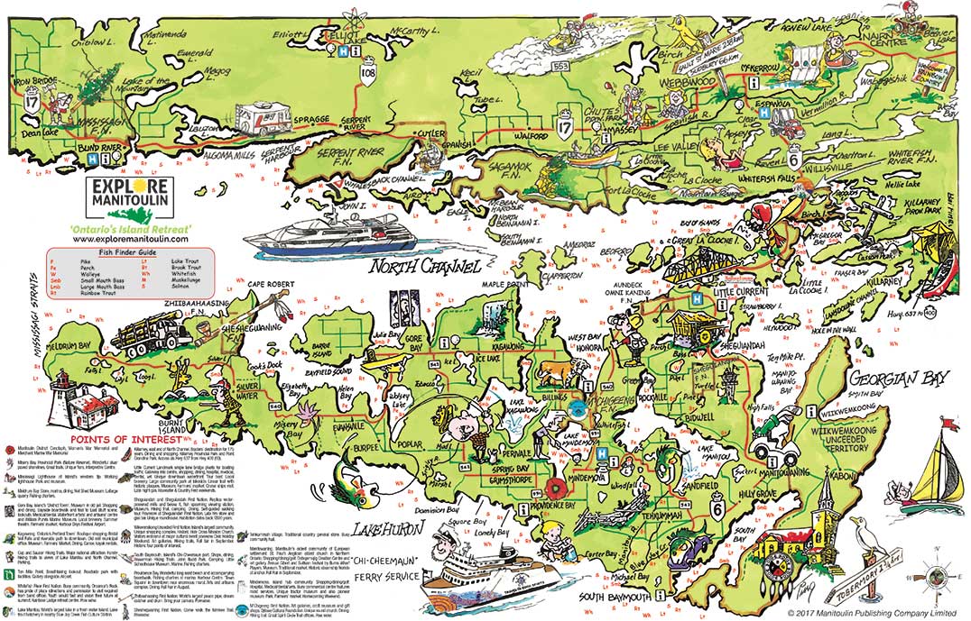
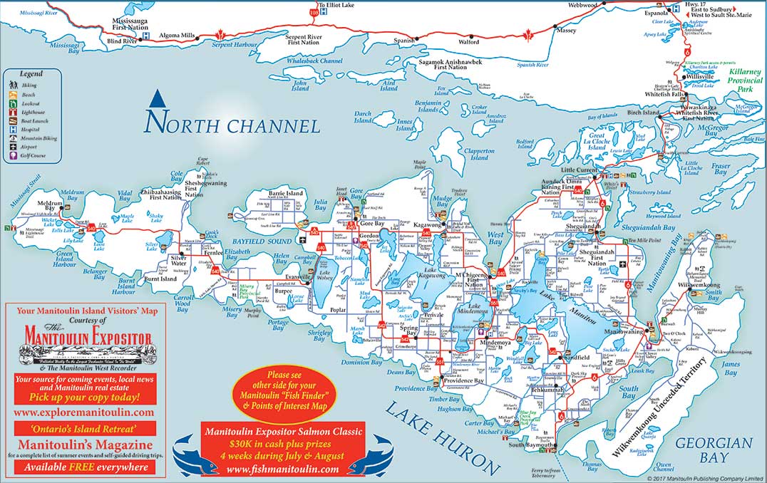
The map indicates public beaches, boat launch sites, lighthouses, hiking trails, lookout points as well as hospitals, golf courses and airports.
The main map is a roads map, created with the help of Island graphic designer Dick Maloney together with The Expositor’s creatives staff and the reverse side is a points-of-interest map, utilizing the old This is Manitoulin map of years ago. This map will also show which fish species are found in which inland lake or river and also in the Island’s surrounding waters. There are brief descriptions of each community’s tourism highlights that can be matched to icons on the map.
“We know there are many good quality collector maps available on Manitoulin, the Turners map or Manitoulin Tourism Association map, for instance, and we recognize that,” Ms. McCutcheon added. “These maps are different in that they are high distribution—15,000 copies to start—that will be available to businesses or organizations that want them and completely for free—we felt that strongly about the need for such a map.”
“It also complements our other endeavours, such as our tourism publications This is Manitoulin and Manitoulin’s Magazine, the Salmon Classic, www.manitoulin.ca, The Manitoulin Expositor and Manitoulin West Recorder as well as a soon-to-be-launched site www.exploremanitoulin.com,” Ms. McCutcheon continued.
“Manitoulin Publishing Co. has always felt passionate about promoting Manitoulin Island as we understand that when Manitoulin is successful, its people are too,” Ms. McCutcheon continued.
The map pads will be available this Friday and can be obtained by stopping into The Expositor Office or by calling 705-368-2744 or emailing expositor@manitoulin.ca.


