WHITEFISH RIVER—After decades of hard work and determination, Whitefish River First Nation can officially count the lands located north of the landmark potholes and surrounding McCutcheon Road, over 1800 acres, to the east of Whitefish Falls once again as their own.
Tuesday, May 16 marked the annual Treaty Annuity Day and as a special feature, the Addition to Reserve (ATR) celebration. The day began with a sunrise ceremony followed by the treaty annuity payments. After a delicious lunch of scone and corn soup (with episodes of Adventures in Rainbow Country providing a backdrop on the big screen), Chief Franklin Paibomsai addressed the celebratory group.
“Today is one of those special days when we get to celebrate the treaty,” Chief Paibomsai said.

The chief explained that part of the treaty process is land. “We’ve been working on it for some time and that land has now been returned to the community—it’s certainly a wonderful thing to celebrate,” he said.
Chief Paibomsai said that the day marked the treaty annuity payment for the 1850 Treaty, for which community members receive $4.
“I think it’s important that we start having conversations about this—our relationship (with the government) goes deeper than the $4,” the chief said.
Chief Paibomsai then walked everyone through the map of the ATR, pointing to the land known as Moose Point (a peninsula jutting into the Bay of Islands) that is still under discussion with the federal government. “It’s time consuming and very frustrating,” he said.
“All that work from the 1970s, 1980s, 1990s and on finally came to fruition,” he said. “Next is Moose Point.”

Chief Paibomsai said that community members will see the First Nation working on gaining lands back north of the defined reserve. “Is that a surprise?’ he asked. “No. That was what Chief Waubekeke told the surveyors (the scope of the territory).”
“We have more territory now than we historically have had,” Chief Paibomsai said, noting the 3.4 kilometres of McCutcheon Road.
“Successive councils have made this happen,” the chief continued. “I just got to see it through. Chi-miigwetch to those councils. They were the start of that work.”
The chief noted the beauty of the new lands, which were acquired last year.
Following an inquiry from the audience as to Killarney Provincial Park and its borders, Chief Paibomsai explained that the park skips over Whitefish River’s territory.
“We are always reminding the province that your boundaries don’t supersede ours,” he added, noting the many layers, from mining to forestry to parks, that infringe on their lands. Lisa McGregor asked what the catalyst was that finally made the ATR happen.
Band Councillor Esther Osche explained that this was the result of much research and document gathering that resulted in a picture of the original territory.
“We (the lands department) were then told by council to talk to the elders,” Councillor Osche continued, adding that this meant going door to door and asking people ‘what do you remember about the land?’
“Elders were integral to the process,” she said. “These missing pieces came together.”
Council then created a plan of retrieval before sitting down with the government to identify the lands and the claims that were staked.
“There are mining claims everywhere,” Councillor Osche said.
The lakebeds were then mapped out.
The lands department discovered through old newspaper ads in the Toronto daily newspapers that there was a 100-year timber lease on Whitefish River lands, but that it had expired in 1965 and that the lands had not been surrendered for sale.
The McCutcheon Road, she explained, was originally created as an unofficial road to Killarney and was the main roadblock the First Nation faced in achieving these lands sooner.
The government agreed, but only after Whitefish River First Nation agreed to leave the road open for those who have land title, such as McGregor Bay cottagers. (It is interesting to note that when the actual building of a road from Whitefish Falls to Killarney was considered in the late 1970s, many McGregor Bay cottagers using this route vigorously opposed improving and developing it, news stories in The Expositor of the time indicated.)

“This is the first time a First Nation has retrieved an underlying easement from the government,” Councillor Osche said proudly. “The only people allowed are us, our invited guests and the cottagers who use the road to access their property.”
“Thirty years is a huge roadblock to economic development,” she said of the wait.
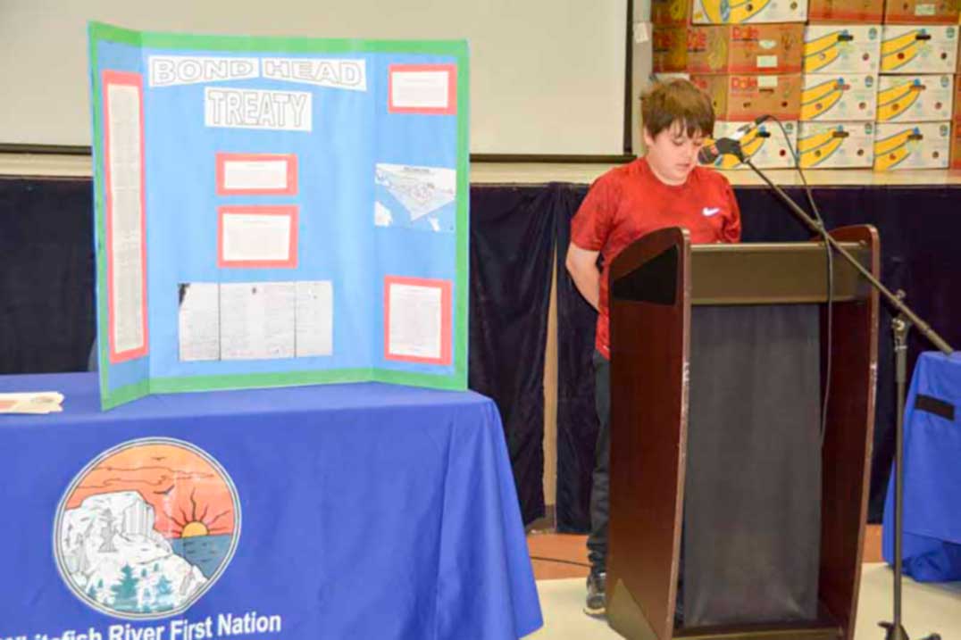
Shawanosowe School students Ira Paibomsai spoke on the 1850 treaty, Carter McGregor the 1836 treaty and Ravon Bowerman, wampum belts.
Alan Corbiere, Anishinaabe historian, was on hand to give a talk on the many Wampum belts with ties to the Whitefish River community and their symbolism, meaning and history, passing around samples of each.
Following the Wampum belt teachings, the assembly drove to McCutcheon Road for the unveiling of the sign announcing the parcel as property of the Whitefish River First Nation and tacking small Whitefish River First Nation logos to the trees lining the 3.4-kilometre road.


