
EDITOR’S NOTE: This year’s series of stories geared to giving tourist visitors insights into activities Manitoulin has to offer will focus on unique experiences available to everyone.
by Isobel Harry
Walking for pleasure in the countryside has grown immensely in popularity since the first recorded tourist visited Manitowaning in 1837, nearly 180 years ago. Manitoulin is renowned as a ‘natural destination’ and from the time of its founding in 1879, the Manitoulin Expositor has promoted the Island’s outdoor attractions, “fishing, yachting, camping, hunting” on its masthead, publicizing the Island’s magnificent scenery and relaxed charm.
Today, Manitoulin is a hiker’s haven, cloud nine for those seeking the quietude of forest paths and babbling brooks, offering many walking experiences from town boardwalks to trails of varying fitness levels in woods, on escarpments and alvar-paved beaches in every corner of the Island. No matter where you are, you will find places to stroll, meander, climb and trek. While most routes are strictly for walkers, some are bicycle and leashed-dog-friendly, others provide access to the physically challenged who require the use of wheelchairs and still others are recommended for younger children pushed in baby strollers or with adults in tow. It’s always best to check first if you are unsure of accessibility.
Here are some of Manitoulin’s premier hikes:
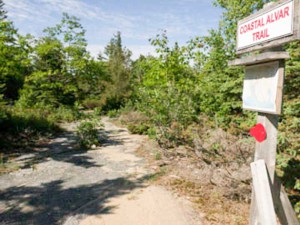
In the west end, 35 kilometres from Gore Bay, Misery Bay Provincial Park (1,100 hectares) offers the largest network of trails (over 21 kms) ranging from 1.2 to 4.8 kilometres in length (one-way), a visitors’ interpretive centre, take-along maps and washrooms. Entry to the park is $2 for adults.
Misery Bay is located on an ancient flat rock sea bottom, raked by the retreating glaciers of Lake Nipissing about 10,000 years ago. Soil is absent from these expansive pavements, called alvars, and water erosion causes deep cracks that sustain rare vegetation unique to the area; some 470 species of plants have been recorded here. According to the website (www.miserybay.org), this unique feature makes Misery Bay a world-class park: “The Manitoulin cluster of alvars are the most significant alvars anywhere in the world.” Classified as a nature reserve by Ontario Parks, Misery Bay protects the alvars, wetlands, upland forests and animal species at risk that are found here.
Walking into the park, the scent of cedars, pines and spruce infuses the air, the utter tranquility only disturbed by fluttering leaves, butterflies and profuse birdsong. Chair of the Friends of Misery Bay (FOMB) board, John Diebolt, out early one morning during the spring bird migration, spotted “palm, pine, yellow-rumped, black and white, chestnut-sided and black-throated green warblers, doves intermixed with nuthatches, a downy woodpecker, a robin and a brilliant flicker.” Visitors may also see turtles and a variety of such other wild creatures as otter, fisher, fox, mink, bald eagles and coyotes. An extensive research project is underway to track the endangered Blanding’s turtles by satellite and motion cameras, as they abound in the park’s wetlands area and while this section is closed to visitors because of the fragile nature of the environment and of the project, it is sometimes possible to see these singular protected creatures elsewhere in the park with their distinctive high domed shells.
Arriving at the sweeping stretches of alvars at the bay after hiking through the verdant woodland paths is a breathtaking encounter with prehistory and a good spot to pause for a picnic and a dip at the beach.
The Friends of Misery Bay is a dedicated group of knowledgeable volunteers who staff the visitors’ centre with its displays of butterflies, turtle shells, animal skulls and bones, bird nests and fossils (these donated by Dr. Al Shawana of Wikwemikong). Books and binders on forest ecology, biology, geology and social history may be perused in comfortable easy chairs. The floor is of polished alvar tiles and the building is solar-powered. A small gift shop offers the park’s motto, ‘Misery Loves Company’ on cards, bags and t-shirts.
On a recent sunny Sunday, FOMB volunteers Linda Olson and Mike Ewart shared their enthusiasm for walking the paths to ensure that the markers clearly point the way; later, FOMB Vice Chair Gaynor Orford and Ontario Parks Senior Planner Will Kershaw spoke of plans for improving the interpretive experience (made possible by a recent $10,000 donation from Lafarge), each conveying an abiding passion for the park. Mr. Kershaw confessed that, of all 117 parks in the northeast zone administrative area, Misery Bay is one of his favorites. Keen to assist visitors, all volunteers and summer students happily answer questions and offer personal experiences and suggestions to make each visit memorable; groups of three persons minimum and larger groups may contact the FOMB ahead of time to arrange guided tours.
The Friends of Misery Bay AGM will be held this Saturday June 28, at 10 am followed by a hike. The guest speaker is Dr. Jackie Litzgus of Laurentian University who will speak on the ‘Turtles of Misery Bay.’
The Visitors’ Centre is staffed and open on Saturdays, Sundays, and holidays from Victoria Day weekend through Thanksgiving from 10 am to 5 pm and daily during July and August. Misery Bay Provincial Park is open year-round. For more information about the park’s programs and about FOMB membership, email info@miserybay.org, visit the website and the FOMB Facebook Page.
Three other provincial parks are under development on Manitoulin: the Queen Elizabeth, the Queen Mother M’Nidoo M’Nissing Protected Area near Silver Water, Strawberry Island near Little Current, and Blue Jay Provincial Park near Sandfield. All three are “non-operating” at this time.
In the east, located in the Wikwemikong Unceded Indian Reserve, the Bebamikawe Memorial Trail (pronounced ‘Bebomkwe’, meaning ‘to leave footprints behind’ or ‘to make a path’) is a professionally built trail system. There are three easy to moderate trail loops geared to hikers of all ages and fitness levels. Four lookouts (three with picnic tables) offer outstanding views over the North Channel to the LaCloche mountain range, Killarney and Cape Smith, with signage detailing the culture, history and heritage of the area and the significance of the view.
As you drive into the village of Wikwemikong, stop at the Tourism Information Centre on the main street for your map and directions to the trails, located at the end of Beach Rd. You may also pick up snacks from the variety stores, restaurants and food vendors in the village

for your picnic. Choose the Fitness Trail, a 1.5 kilometre two-track path that is mountain-bike friendly, leading to a waterfront gazebo with exercise equipment set up at stations for an extra workout; the Three Fires Trail, an intermediate 4.4 kilometre course with railings, or the Warriors Trail, lined with historical artifacts. All loop back to the main trail. Guided tours of two to four hours are available with 24-hours advance notice (two persons minimum); and a personalized itinerary is designed around your interests in wildlife and the spiritual, medical and utilitarian use of local plants. For more information call Wikwemikong Tourism at 1-888-801-9422 or 705-859-3477, email inquiries@wikwemikong.ca or visit www.wikwemikong.ca.
Other favorite trails to try are:
South Baymouth Trail––A one-hour trail up limestone steps through the bush with Lake Huron views. Before or after your journey on the Chi-Cheemaun ferry, access is south of the terminal building across from the boat launch, off the small boat harbour parking lot or off Green Street.
Gordon’s Park—In a private park, three trails through five eco-systems (wetland, forest, meadow, pond, escarpment). An interpretive centre features mounted displays of bears, wolves, hawks and owls and information on fossils, edible wild plants, trees and wildflowers. There is also an observation deck, bird blind, picnic area, pool, mini-putt, camping and tipi tenting, b&b, store and dark sky sanctuary with astronomy observatory. On Hwy 6 north of South Baymouth. For more information and rates, visit www.gordonspark.com
McLean’s Park—Easy three kilometre trail on old logging roads in 100 acres of old hardwood bush with washrooms at the trailhead. On the scenic New England Road off Highway 6 between South Baymouth and Manitowaning.
Lewis Twin Peaks Hiking Trail—Easy two-kilometre trail with dramatic views of Bass Lake and the North Channel from quartzite outcrop lookouts; in Sheguiandah, on the west side of Highway 6.
The Cup and Saucer Hiking Trails—12km of trails that form part of the Niagara Escarpment, with panoramic vistas Lake Manitou’s Green Bay and also the North Channel. Well worth the three hour walk and climb, although it’s not necessary to hike for that long to experience great views. On the Bidwell Road just off Hwy 540; closed at sunset, and not recommended for children under seven years of age.
Wagg’s Woods – An easy one-hour walk in a dense 49-acre forest of maple, birch, basswood, wildflowers, 15 species of ferns and mossy cliffs of the Niagara escarpment. Situated on A.J. Wagg’s original pioWneer farm off Mindemoya’s main street. (Mr. Wagg was the founder of Mindemoya’s dairy operations, and of Wagg’s Creamery, in 1902.)
Bridal Veil Falls River Trail—It takes about 30 minutes to walk the leafy trail that follows the stream starting at the base of the falls, descending past a small generating station to the North Channel’s Mudge Bay in Kagawong. Those with physical challenges in navigating the long staircase down to the base of the falls can access the trail in the town near the Old Mill. Off Highway 540 at the entrance to the Village of Kagawong at Bridal Veil Falls.
Nimkees Hiking Trail—For hikers and mountain bikers, this 20km trail, divided into several sections, leads to Cunningham beach, or to Cape Robert, where there was a lighthouse built in 1885. With advance notice, groups of 12 may rent Nishin Lodge; catering and guides can be arranged. In Sheshegwaning First Nation; for trail and lodge information, telephone the band office at 705-283-3292, or drop in.
Mississagi Lighthouse—Short trails over limestone ledges, around enormous boulders and rock fissures, offering impressive views of the Mississagi Straits of Lake Huron; there is a restaurant, museum and sites for picnics and camping. Just before Meldrum Bay, turn left for the 10km drive to the Mississagi lighthouse, built in 1873. Open every day 8 am to 8 pm from the last weekend of June until the third Saturday in September.
Heaven’s Gate Trail (off-Island)—An approximately 50-kilometre trail for multi-day hike through the LaCloche Mountains with views of the North Channel and surrounding lakes. This ambitious trail runs through to Fort LaCloche on the Sagamok First Nation, south of Massey. Trail markers; recommended only for very skilled hikers. Access from Whitefish Falls/Willisville Road on Highway 6. Native-themed guided hikes and canoe tours are available by contacting Sagamok Tourism by phone: 705-869-7937, or email Matthew Owl: matthew@sagamokdc.ca
For more information on what to see and do on Manitoulin, visit thisismanitoulin.com, and the weekly newspapers for coming events listings, The Manitoulin Expositor and The Manitoulin West Recorder or visit www.manitoulin.ca. Be sure to pick up a copy of This is Manitoulin and Manitoulin’s Magazine 2014 at tourist booths and local businesses.
Before heading out on your hike, plan ahead: wear comfortable walking or hiking shoes, a couple of layers of shirt and t-shirt to peel off or add on as the weather requires, and take along a hat against the sun or a sudden downpour. Sunscreen and insect repellent are the choice of many. A supply of water and snacks for energy complete the basic kit. Anything else is up to you: folding campstool, sketchbook, binoculars, walking stick, map, compass, book, swimsuit, camera, blanket, picnic. A cardinal rule is not to leave anything behind, “only footprints,” ensuring that the pristine environment you enjoyed will be as unspoiled for the next hiker. Follow posted rules and trail markers and your day will be as cloudless as a Manitoulin summer sky.

